Geological Overview
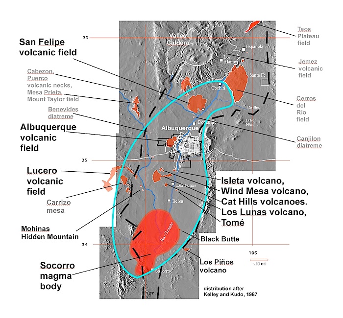
The Rio Grande rift is segmented into a series of basins; the Albuquerque basin being one of them. It is bounded on the north by the La Bajada fault, which defines the southern margin of the Española basin, and to the south by the Socorro constriction.
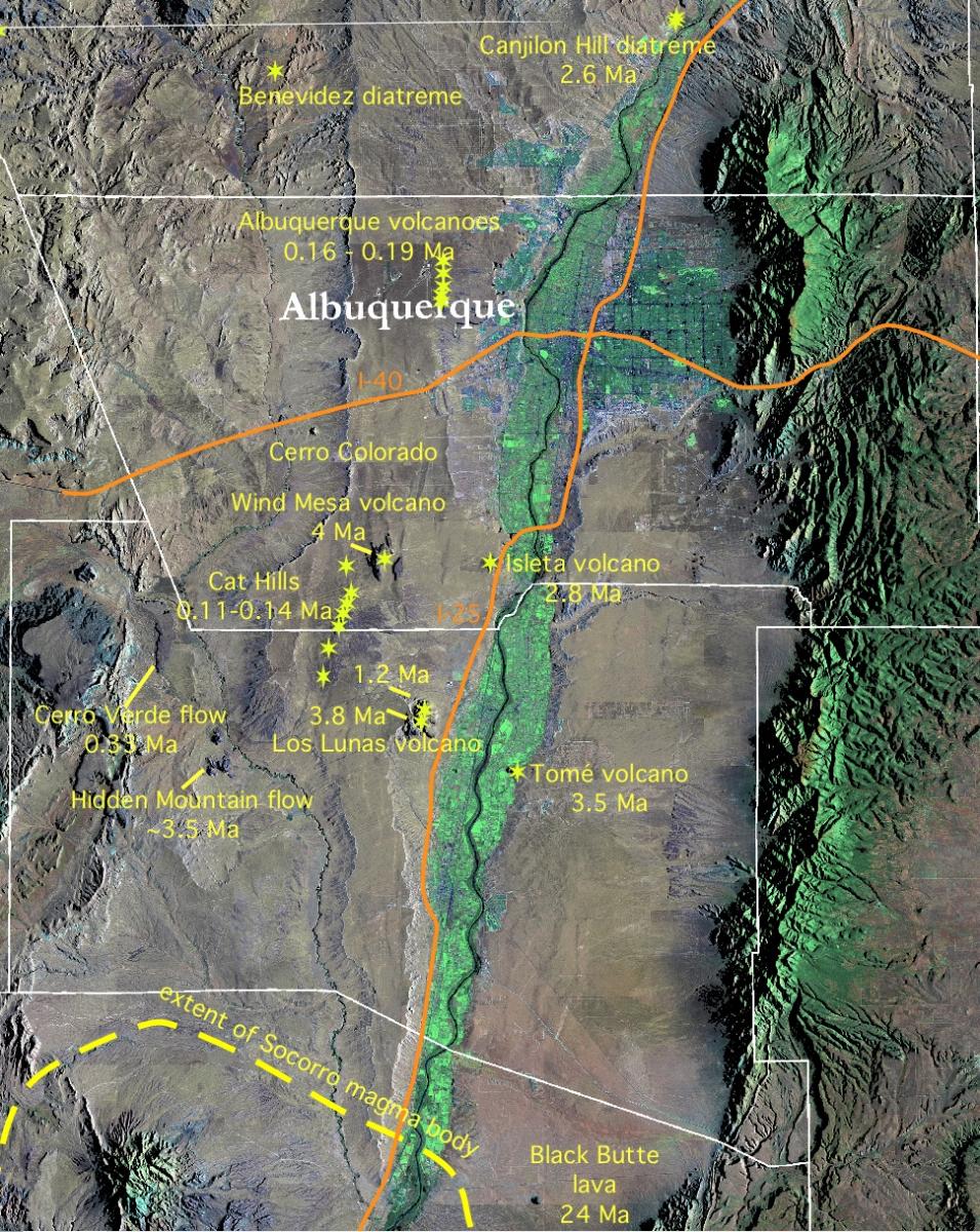
Volcanism is distributed throughout the ABQ basin and the Albuquerque volcanoes are only one among several young volcanic features near Albuquerque. Although most of these volcanic areas consist of dark, relatively low silica, and relatively fluid basalt lava flow and scoria eruptions, andesitic and more silicic compositions are represented in some of the volcanic centers, especially at depth within the rift valley basin fill. This means that although volcanism appears to be minor and only manifests itself in a few places in the current rift valley floor, there has been much more volcanism within the Albuquerque basin segment of the Rio Grande rift over the past several million years and it is simply buried in the sediments filling the rift. We only see some of the last erutive activity.
From most locations in Albuquerque there are several shield volcanoes visible to the north and south in addition to the Albuquerque volcanoes. Many of the mountains visible from Albuquerque, such as the Jemez Mountains to the north and Mount Taylor to the west are relatively young (meaning, still morphologically preserved) volcanoes.
Summary of Locations and Known Ages of Volcanoes in the Albuquerque Basin, Rio Grande rift
Albuquerque Volcanoes
(The following is about the Albuquerque Volcanoes. For informatin about the Cat Hills, Los Lunas, and Tomé volcanoes, go here.)
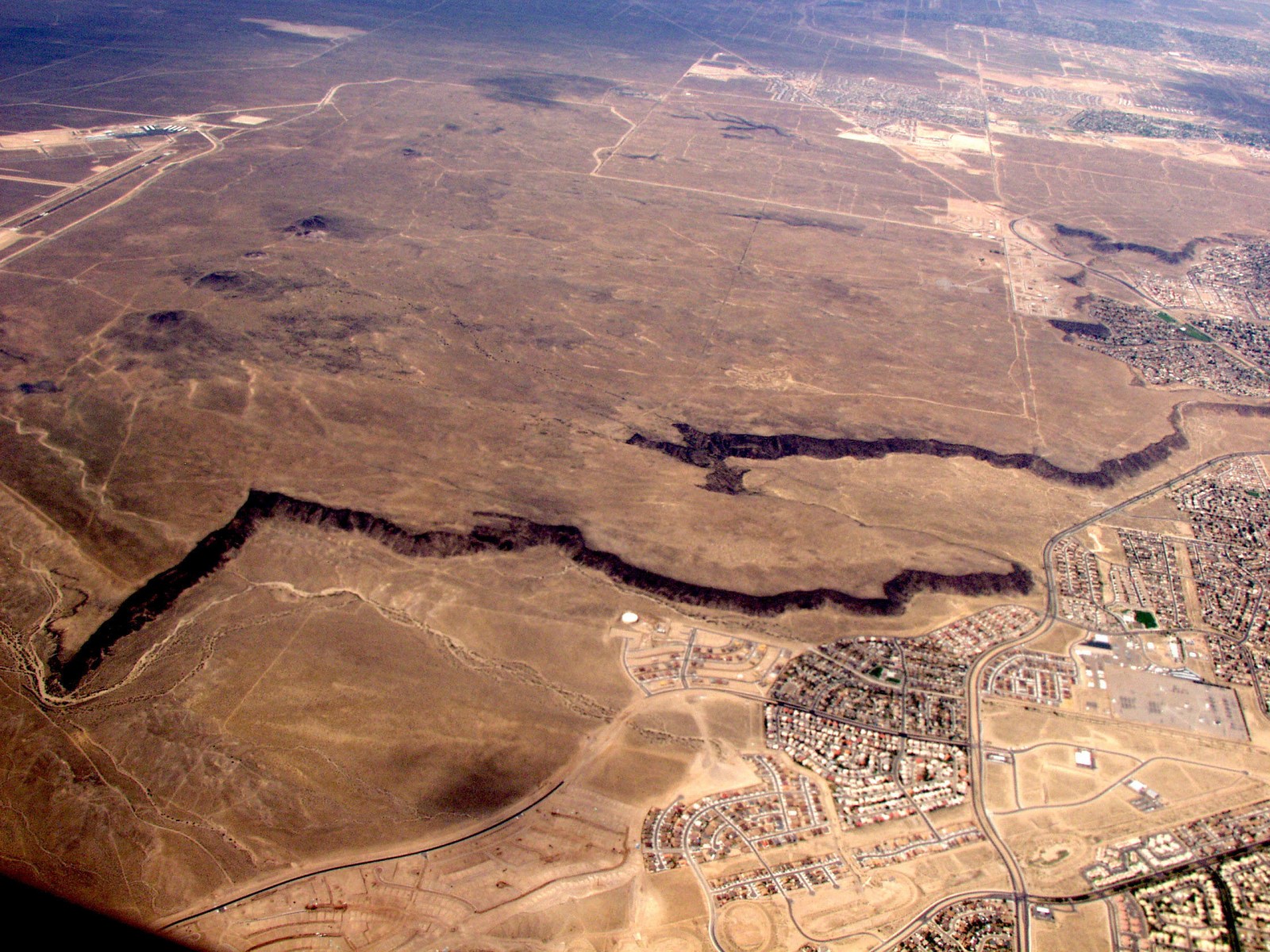
View of the Albuquerque Volcanoes from 10,000 feet. Note the lobe-shaped mesas whose margins outline the original flows. The direction of flow was away from the fissure vent which is visible in this image as an alignment of small cones. Petroglyph National Monument is located along the rocky escarpment. Photo L. Crumpler
The Albuquerque Volcanoes exhibit many unique volcanic features and you can see them on a short hike if you know where to look. For example, at the largest cone, "Vulcan volcano", the cone consists mostly of scoria and ash, but has a carapice of spatter and lava coating the exterior. Gradual weathering of the loose cinders in these places has created cavernous holes. These look like lava tubes but actually were formed by a different process. Then there are other places on the larger cones where lava flowed in small gutters perfectly preserved with the last flows on the gutter floors.
Two humps on the south side of Vulcan are actually small volcanoes. You can stand on their tops and actually see the craters surrounded by outward-dipping spatter and lava flows.
The Albuquerque Volcanoes are the source of lavas that make up the escarpment of the Petroglyphs National Monument. In places the cliffs are over a hundred feet high. But the lava flows are only six to ten feet thick in most places and occur as a cap rock resting on softer underlying rift basin fill consisting of sands and gravels. The rest of the cliff or petroglyph slope is just armored with blocks of basalt that have tumbled from the relatively thin lava flow cap rock. Judging from these high cliffs at the edge of the lava field, one might also suppose that the volcanoes are old. But the Volcano Cliffs, as they are known locally, formed only because the Rio Grande flow gradually cut down its channel and the lateral erosion of the landscape has encroached on the lava flows from the volcanoes under cutting them and leaving them perched on escarpments.
Here is the important thing about the Albuquerque Volcanoes: Few large cities in the United States have young volcanoes near them. The Albuquerque Volcanoes are geologically young (dates range between about 190,000 and 220,000 years old) so many details of small eruptions are well preserved. What is ironic is the fact that most residents see them as such small hills on the western horizon that they could not possibly be of any interest. But it turns out that they preserve some really unusual characteristics not seen in other more spectacular volcanic settings.
They are also an excellent example of the results of a fissure eruption in which a curtain of fire erupts from a long, linear crack. Fissure eruptions like the Albuquerque Volcanoes are common in many parts of the world, particularly oceanic island volcanoes, but are not as well-expressed throughout much of the Southwest.
The Albuquerque Volcanoes we see today are the result of a fissure eruption associated with the Rio Grand rift. Fissure eruptions form because molten rock, or magma, tends to rise along vertical cracks. When the cracks reach the surface, they cause long surface fissures. Lava and ash then erupt from the fissure. As magma quickly cools and solidifies along most of the crack, only a few points continue to erupt. Small cones of ash, spatter, and lava are built as these points of eruption continue.
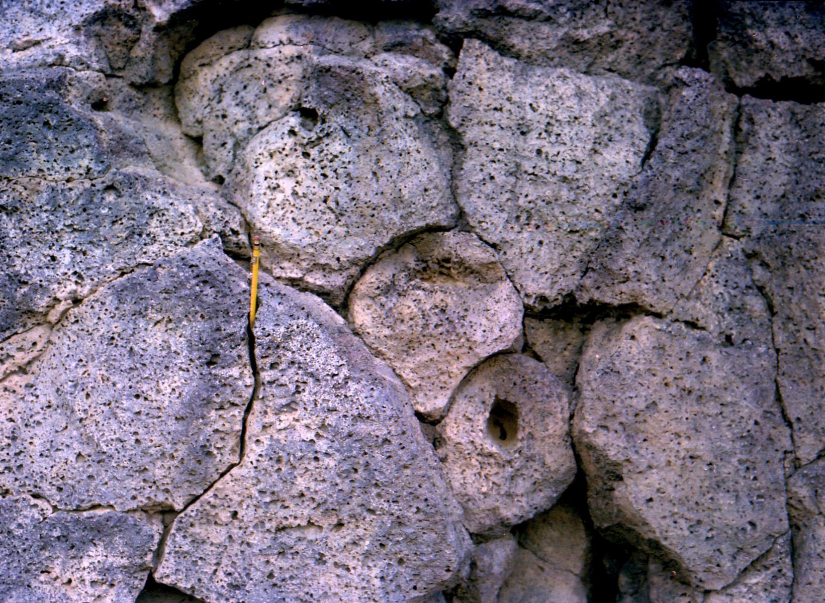
Overlapping toes or lobes of lava in section in the northern margins of the Albuquerque Volcanoes lava flow field. Photo by L. Crumpler
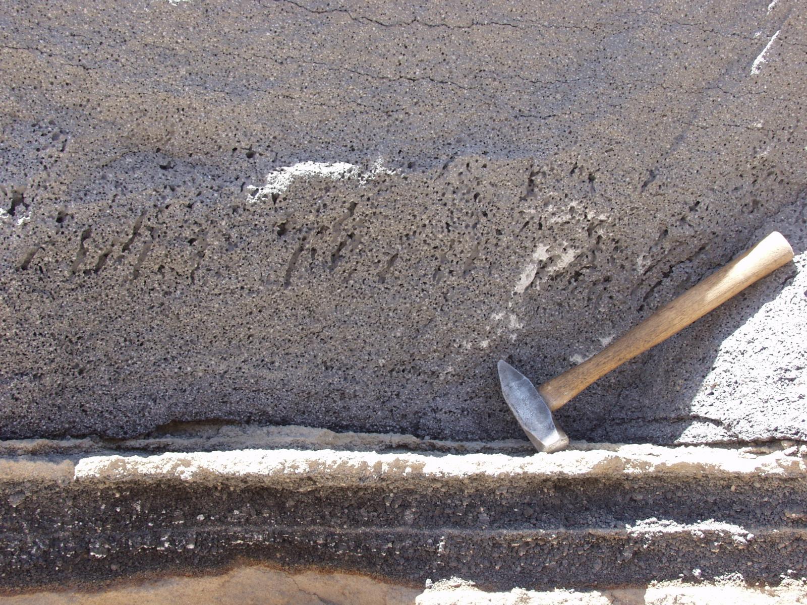
ALbuquerque Volcanoes lava flow resting on sequence of basaltic ash. Note pipe vesicles that are inclined in the direction of lava flow. THis section was exposed during contruction of the Paseo del Norte road cut. Photo by L. Crumpler
Trail Guide to the Black Volcano, Albuquerque Volcanoes
(Guide is referenced to numbers on the overhead air photo and map of trail below)
1. Trail head area. From here one may see three of the main cones that make up the north-south line of cones that are known as the Albuquerque Volcanoes; to the north is Vulcan volcano, then Black volcano, and closest to us is JA volcano. To understand what you are looking at, imagine JA Volcxano to out immediate east with a fire fountain spraying several hundred feet into the air, collapsing into pools on the slopes, and running away in re-hot streams of molten rock. This is what it looked like just before the eruption came to an end and there has been very little erosion since.
Other features to note here:
-The mass of the Sandia Mountains, literally the oldest rock in the Albuquerque area (1.4 billion years old), is visible to the east and juxtaposed behind the volcanoes to the east in stark contrast to the 220,000-year age of the volcanoes. The Manzano Mountains are to the southeast.
-Mount Taylor composite volcano, 2.5 million years old, is visible due west on the horizon. The Mount Taylor summit amphitheater, much like the one that we will walk through on this trail, opens towards us. The two sides and back of the amphitheater crater give the appearance from Albuquerque of a three-summit mountain.
Begin walking up the trail from the parking area toward JA volcano. Notice that each of the volcanoes clearly has a ramp or apron of lavas around their bases
2. Just where the trail approaches near the lower slopes of JA Volcano there are many white-coated rocks exposed in the trail. This is common in the Southwest. It is called caliche, and is formed by calcium carbonate, similar to the deposits left by hard water around your faucet. There are several hypotheses concerning caliche; it may be formed from ground water, deposited by surface rainfall, or may even be associated with the increased carbon dioxide associated with volcanism.
Note that the basalt has many gas bubbles or “vesicles”. The vesicles are remnants of the gas (primarily carbon dioxide gas and water vapor) that is inherent in the magma and helps to drive the eruption. Throughout the traverse, note how the vesicle size and number change depending on the type of outcrop features. As you continue on the trail, look for the beginning of a lava flow associated with JA volcano. Lava flows are mostly to the east because the gradient at the time of eruption was toward the Rio Grande, but the build-up of the fissure line and the main volcanoes created a slope that sent many flows to the west.
As you continue to walk, you will climb up on the apron around JA Volcano that was formed from small digitate (finger-like), radiating lava flows. These form a platform around the base of the volcano. These are clearly visible in the air photo (see title page). The lava flows around Black Volcano and somewhat larger and tended to pond forming a series of steps in the cone slopes. You may be able to see these benches or steps from here.
3. This is the second rest stop along the trail. At this point you are standing on the fissure line between JA volcano and Black volcano to the north. A little-known detail about fissure eruptions and particularly noticeable here in the Albuquerque Volcanoes fissure line is that volcanoes are not exactly aligned along the 10 km fissure trend. Each of the major volcanoes is actually on a separate shorter fissure that trends at a small angle to the northeast from the main trend line. This is because fissures in the deep crust tend to splay into shorter fissures in the upper crust due to peculiarities of the strength of rocks. Think “cracks in sidewalks” or “cracks on a wall.” They tend to be en echelon rather than one big, long crack.
Notice that Black volcano looks flat-topped from here. That is actually the rim of the summit crater that we will be climbing into. JA Volcano on the south side of the trail is a perfect example of a cinder/spatter cone with associated lava flows. As you walk past JA cone you will see evidence for red-colored scoria and cinder on the lower slopes. Unlike Black Volcano, JA Volcano has more exposures of cinder. Both volcanoes have later flows covering their slopes to the east and west and the cinders tend to be exposed on the north and south flanks.
4. The trail turns north at another rest stop where you have an excellent view of the Rio Grande valley making up the eastern half of the Rio Grande rift. Here on the fissure line of the Albuquerque volcanoes you are standing very near the center of the Rio Grande rift. The rift at the latitude of Albuquerque encompasses the area between the Rio Puerco over the western horizon and the Sandia Mountains on the east side.
From here one has an excellent view of the inner valley of the Rio Grande that includes most of the modern flood plain and is bound on the east and west by the “sandhills.” The river is the “gift of the rift” and has taken advantage of the low area produced by the rift to flow down the center of the state. This is a good place to consider the diversity of rock ages and landscapes in the Albuquerque area, and evidence for past and present geologic forces, all of which are uniquely visible from this single site.
Continue on the trail toward Black Volcano. Notice that very little lava is exposed in the saddle between JA Volcano and Black Volcano. The lava is there, but in this case it has been buried under thousands of years of dust from the west. As you walk up the trail, keep in mind that the lava flows and cinders and spatter erupted here are among the last volcanic material to be erupted from the fissure. Keep an eye open for how the last erupted material may differ from early lavas that make up much of the landscape to our east.
5. First outcrop up on the southeast margin of Black Volcano. The outcrops here are very vesicular, so we are seeing close to the top of uneroded lava flows making up the lower slopes of Black Volcano at this location. But the “outcrops” are all bulbous and irregular. This is because these are lava flows that have cascaded down the slopes and experience many local breakouts as they cooled and crusted over. As you climb up onto this black basaltic surface notice that the trail is suddenly populated with black vesicular white caliche-covered rocks. See if you can spot any digitate or finger-like flows in the shape of the miscellaneous outcrops on either side of the trail. In air photos you can make out flows radiating from the volcano. Can you spot them on the ground?
6. The trail passes into the earlier of two overlapping summit craters. Along with general dust and alluvium filling the crater, there are some reddish areas of scoria and ash making up the rim and floor of the cone. It is also a flattish area, with ramparts or margins of the dark basalt that makes up the outside of the volcano. If you look closely as we circle around the craters, you may get a sense of foliations or layers in the basalt that tell us which way the lava was flowing: In? Out? Flat-lying lava pond?
While we are up here on this prominent topographic peak, look for fulgarites on some of the boulders surrounding the summit craters. Fulgarites in this area are dark green to black glassy mark around a centimeter in diameter made by lightning strikes. Over 200, 000 years there have been many lightning strikes on these peaks since they are the highest features on the west mesa.
7. The trail enters a slightly higher elevation and the floor of the second crater. . Instead of just general soils and alluvium filling the crater here, the floor of the crater consists of scoria and cinder. The craters have not been eroded and filled all that much with later non-volcanic material. The presence of scoria and cinder here tells us that while the outside of the volcano makes it appear that the whole volcano is just dark basaltic lava, actually the basalt on the slopes is just a coating on a scoria cone much like JA Volcano to the south.
This is an original geologic surface; so all the scattered rocks and disturbed features up here are the result of later activity, mostly human.
8. The west rim of the second crater is the highest point on Black Volcano. This is a perfect place to view most of the rift valley. The Sangre de Cristo Mountains may be seen on a clear day to the northeast and just east of Santa Fe. To the east you have an excellent view of the Rio Grande valley and the eastern margin of the Rio Grande rift (formed by the fault block Sandia, Manzanita, and Manzano Mountains). In the distance to the northeast is the San Felipe shield volcano on the mesa top above San Felipe Pueblo. To the left of that is the rim of the Valles Caldera. To the south, Isleta and Los Lunas volcanoes are visible in the near distance, and beyond them to the southwest, is Sierra Ladron, which is an uplifted block of the old crystalline “basement rock” similar to the Sandia Mountains.
Here the basalt appears mostly flat-lying but tips over onto the west slope of the volcano. If you walk 10 feet or so to the west-northwest from the summit you will see a “lava gutter”. Lava gutters are small lava channels. While they are relatively rare, lava gutters appear to be a specialty of the Albuquerque Volcanoes. If you look carefully enough, each of the volcanoes has several good examples of lava gutters. This particular example emerges from a small lava tunnel that probably drained a summit lava pond.
9. The north rim of the second crater is a well-preserved lava channel complete with levees (Figure 3). Like the lava gutters, but bigger and flat-floored, a leveed lava channel in this location must represent one of the last events in the eruption of Black Volcano. If you look carefully, you can make out the rubbly basalt stuck to the floor of the channel in its last position before everything shut down. In a sense you are looking at a lava stream that was frozen in the channel 200, 000 years ago and has remained that way since. That is an old landscape and a far cry from the mostly recent vegetated and eroded landscape of wetter parts of the continent. (Think “old-growth forest” on steroids.)
One final feature located on the east margin of this channel is something of a mystery (Figure 4). It is a vertical cylindrical hole in the lava about 10 cm in diameter. Although it could easily be a later flagpole hole, it is not. If you look closely you can see that the original lava itself has faint foliations or bands that wrap around the hole. So it appears to have been an obstacle in the original lava. Anywhere else this would be an excellent candidate for a tree mold. But on the summit of an erupting volcano? We are missing something in our understanding here.
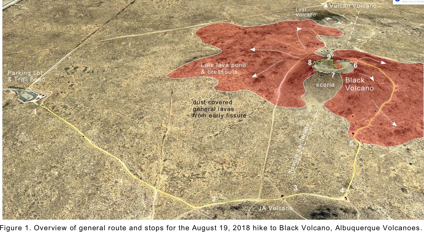
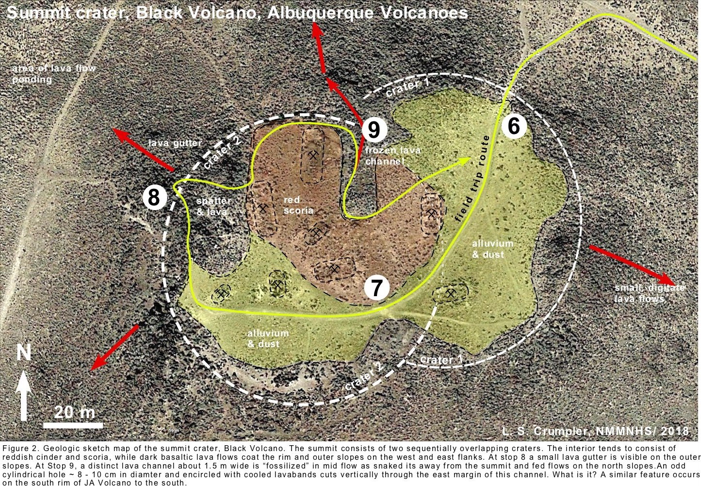
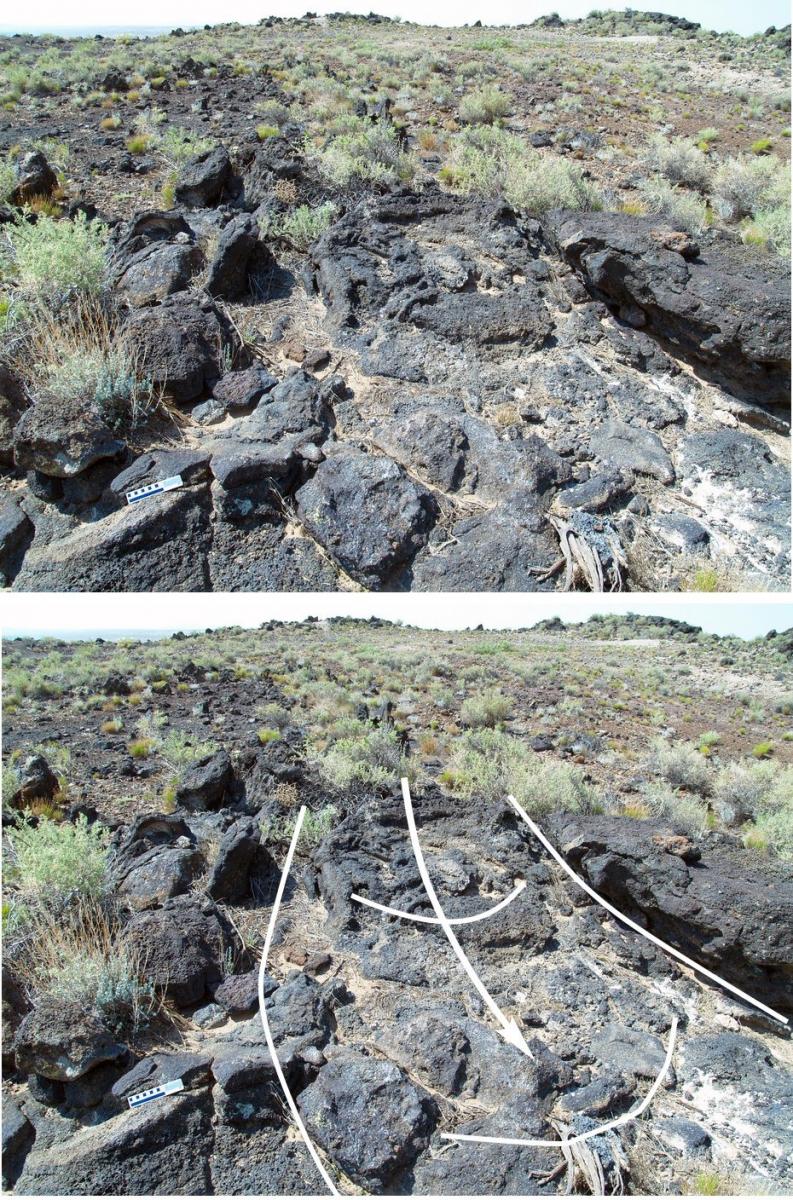
Figure 3. Lava channel on north margin of summit crater, Black Volcano.
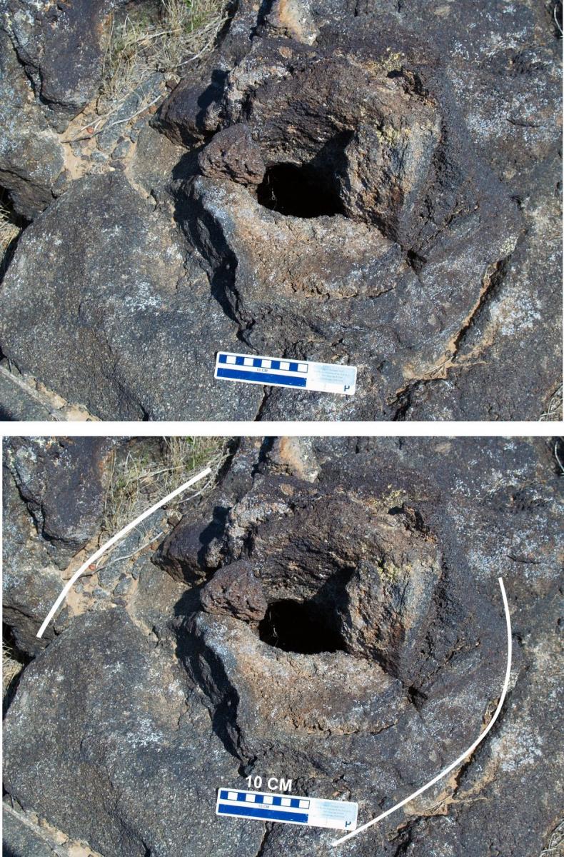
Figure 4. Cylindrical, vertical mystery hole in lavas forming part of the marginal levee of the lava channel shown in Figure 3.
End of Field Trip
The Park Service Says that we must Return to Trail Head Same Route! Argh!!
Trail Guide to the JA Volcano, Albuquerque Volcanoes
[Currently, the National Park Service has closed access to JA Volcano. In order to follow the guide below, you must obtain permission to access the JA volcano trail from the Petroglyph National Monument vistor's center.]
(Guide is referenced to numbers on overhead air photo and map of trail)
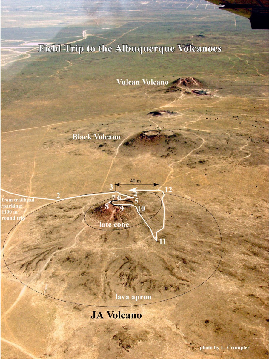
Points of interest along the JA volcano trail.
1. Trail head area: From here one may see three of the main cones that make up the north-south line of cones known as the Albuquerque Volcanoes; to the north is Vulcan volcano, then Black volcano, and closest to us is JA volcano.
-The mass of the Sandia Mountains, literally the oldest rock in the Albuquerque area (1.4 billion years old), is visible to the east and juxtaposed behind the volcanoes to the east in stark contrast to the 220,000-year age of the volcanoes. The Manzano Mountains are to the southeast.
-Mount Taylor composite volcano, 2.5 million years old, is visible due west on the horizon. The Mount Taylor summit amphitheater, much like the one that we will walk through on this trail, opens towards us. The two sides and back of the amphitheater crater give the appearance from Albuquerque of a three-summit mountain.
Begin walking up the trail from the parking area toward JA volcano. Notice that each of the volcanoes clearly has a ramp or apron of lavas around their bases.
2. Just to the east of the white arrow at the trail side there are many white-coated rocks exposed in the trail. This is common in the Southwest. It is called caliche, and is formed by calcium carbonate, similar to the deposits left by hard water around your faucet. There are several hypotheses concerning caliche; it may be formed from ground water, deposited by surface rainfall, or may even be associated with the increased carbon dioxide associated with volcanism. Note that the basalt has many gas bubbles or “vesicles”. The vesicles are remnants of the gas (primarily carbon dioxide gas and water vapor) that is inherent in the magma and helps to drive the eruption. Throughout the traverse, note how the vesicle size and number change depending on the type of outcrop features. As you continue on the trail, look for the beginning of a lava flow associated with JA volcano. Lava flows are mostly to the east-west because the gradient at the time of eruption was toward the Rio Grande. As you continue to walk, you will climb up on the apron of small digitate (finger-like), radiating lava flows that form a platform around the base of the volcano. These are clearly visible in the air photo and were erupted on top of the first lava flow you saw on the trail.
3. This is the second rest stop along the trail. At this point you are standing on the fissure line between JA volcano and Black volcano to the north. Notice that Black volcano looks flat-topped from here. That is actually the rim of the summit crater.
To the east you have an excellent view of the Rio Grande valley. Here on the fissure line of the Albuquerque Volcanoes you are standing very near the center of the Rio Grande rift. The rift starts in the area of the Rio Puerco over the western horizon and goes all the way over to the base of the Sandia Mountains.
JA volcano is a perfect example of a cinder/spatter cone with associated lava flows. As you walk up JA cone you will see excellent examples of many of the physical and textural features of a cinder cone-style volcano.
Start the ascent up the trail toward the summit of JA cone. As you walk up the trail, keep in mind that the lava flows, cinders and spatter erupted here are among the last volcanic material to be erupted from the fissure. Keep an eye open for how the last erupted material may differ from early lavas.
4. First outcrop up on the north flank of JA volcano.
-small opening surrounded by moss near the edge to west of the trail = moist ambient subsurface air. Hold your hand in front of this opening (do not reach inside) and you will feel warm air in winter and cool air in summer. The warm air has made many people believe that the volcano is still active; however, you are simply feeling the ambient air temperature protected by the insulation properties of the basalt.
-large spatter lumps and agglomerated fluid clasts may be seen in some of the outcrops.
5. Farther up the slope you arrive at a large cave. This may be part of a small lava tube that formed in the lavas that were draining away from the summit of the volcano. Note the odd lumpy shapes of the lava – formed by welded spatter. Notice that above the opening there is a fragment of pre-existing rock (sandstone) that has been caught up in the eruption. Do not go inside. As you continue up and around the “cave” and follow the trail you will see a classic lava gutter to your left just above the “cave.” The layers in the upper walls of the gutter illustrate one way that an open channel or gutter may evolve into a closed tube as an eruption progresses and walls build up and solidify into a roof.
6. The trail passes through a reddish area that is scoria and ash making up the rim of the main crater. It is also a flattish area, with outward dipping margins, that appears to have provided a source for the lava tube and gutter we just walked past, so this is probably a small vent area or short-lived lava pond. The question here is why is some scoria black and some red? The answer is probably small changes in oxygen gas content causing oxidation in some areas and not in others – but this is a question that is still not totally solved by volcanologists. The basalt lava around the margins and just west along the rim here is very dark, but banded as though made up of many pulses. Look for fulgarites (glassy marks of lightning strikes) on some of the boulders surrounding the lava pond.
7. The outcrops here are bedded or banded, and the plane of the bands slope or dip towards the center of the main crater. Locally the surface of the lava and spatter is grooved; these are stretch marks as the hot and plastic spatter slid down the rim toward the crater.
8. The multiple bands of light and dark lava here shows how the eruption changes back and forth from more solidified pyroclastic clots to fluid clots that are hot enough to weld together.
9. Here on the south rim one may see many separate layers of spatter that built up as the volcano erupted. Walk up the trail to the inward dipping layers of spatter on the west rim of the crater or walk on the trail across the crater to the south rim. Both sites will give you a close-up view of the welded layers of spatter. Notice the layers of fluid-looking spatter that have welded together to form solid rock. They were erupted as part of the fire-fountaining of the crater and then fell back into the crater welding into solid rock and forming inward-dipping coating.
This is a perfect place to view most of the rift valley. The Sangre de Cristo Mountains may be seen on a clear day to the northeast and just east of Santa Fe. To the east you have an excellent view of the Rio Grande valley and the eastern margin of the Rio Grande rift (formed by the fault block Sandia, Manzanita, and Manzano Mountains). In the near distance to the northeast is the San Felipe shield volcano on the mesa top above San Felipe Pueblo. To the south, Isleta and Los Lunas volcanoes are visible in the near distance, and beyond them to the southwest, is Sierra Ladron, which is an uplift similar to the Sandias that marks the western margin of the rift.
10. The low notch on the east side of the crater here is not just the result of water erosion. If you look carefully, you will see evidence that lava actually poured out the crater here and left behind fins and grooves. As you walk down this notch, you will walk along the geologic contact between the scoria/spatter forming the volcano and the youngest lava flow erupted from the crater late in the history of the cinder cone. The lava that flowed out from this volcano probably supplied the lava flows that make up the escarpment lavas visible way off to the east near Unser Boulevard and Rinconada Canyon. Many of the same features that we have seen in the lava flows here may also be found at the head of Rinconada Canyon.
11. Down here we are off the main cone and on the apron of lava flows. At this point someone has penetrated the lava flows and exposed clinkery cinder that was erupted just before these very last lava flows. The opening has also exposed what may be one of many small discontinuous lava tubes within the lava flows of the Albuquerque volcanic field.
12. The third rest area. From here you have an excellent view of the inner valley of the Rio Grande from the center of the Rio Grande rift. The river is the “gift of the rift” and has taken advantage of the low area produced by the rift to flow down the center of the state. This is a good place to consider the diversity of rock ages and landscapes in the Albuquerque area, and evidence for past and present geologic forces, all of which are uniquely visible from this single site. And JA volcano is a remarkable example of fissure-style cinder/spatter cone.
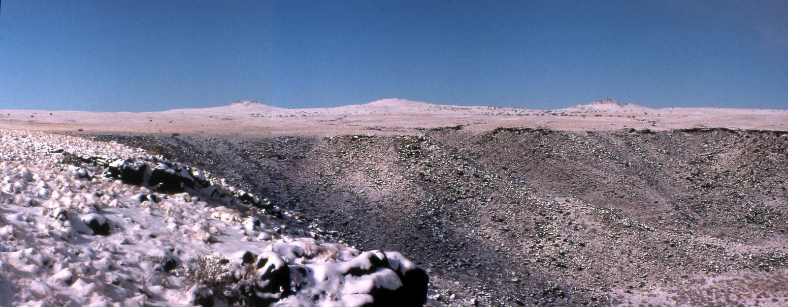
Winter scene of the southern three vents of the Albuquerque Volcanoes. The view is west at the head of Rinconada Canyon. Photo L. Crumpler
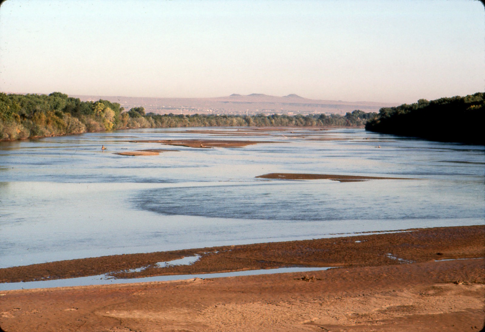
View north of the Albuqueruqe Volcanoes from the bridge over the Rio Grande along I-25. Photo L. Crumpler
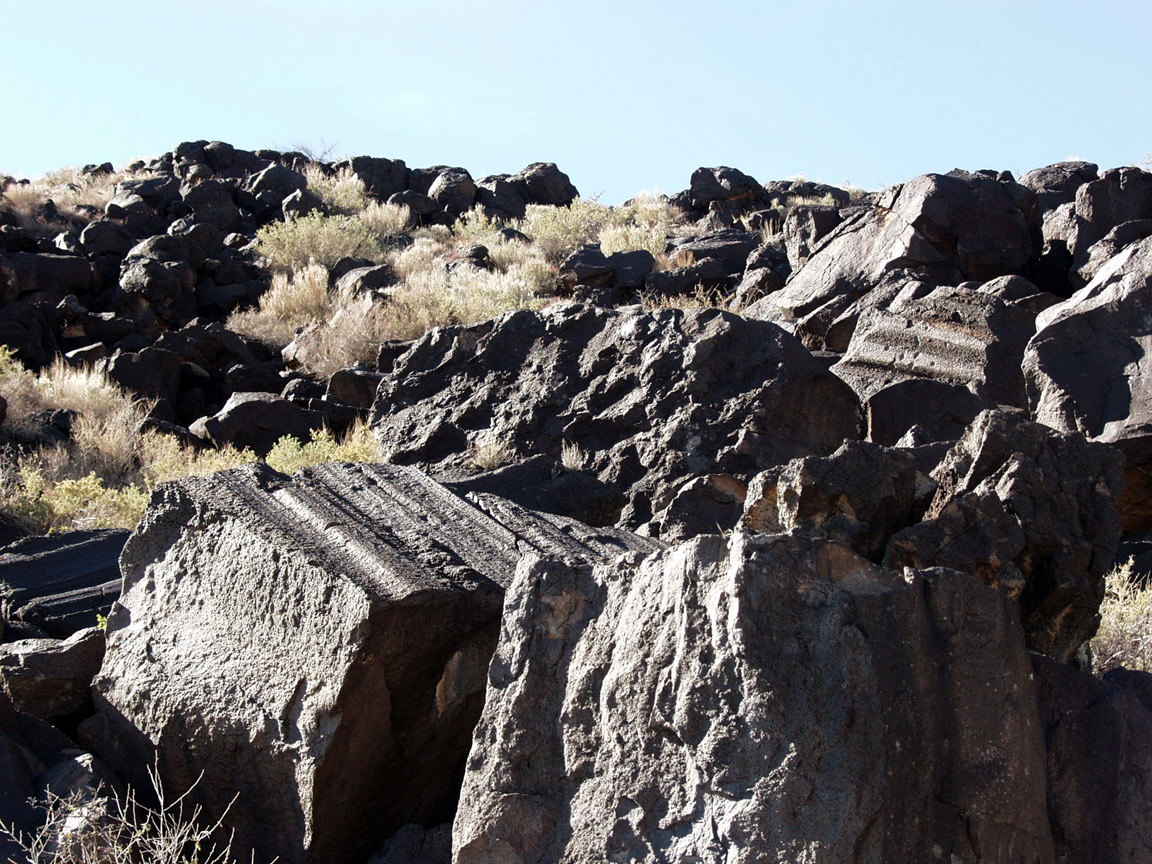
Blocks of grooved lava denoting the former interior of lava tubes at the southern tip of Mesa Prieta, the southern tip of the Albuquerque volcanic field. Photo L. Crumpler.
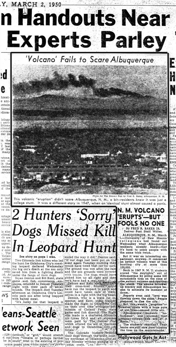
A newspaper story about one of the many previous "eruptions" of the Albuquerque volcanoes!
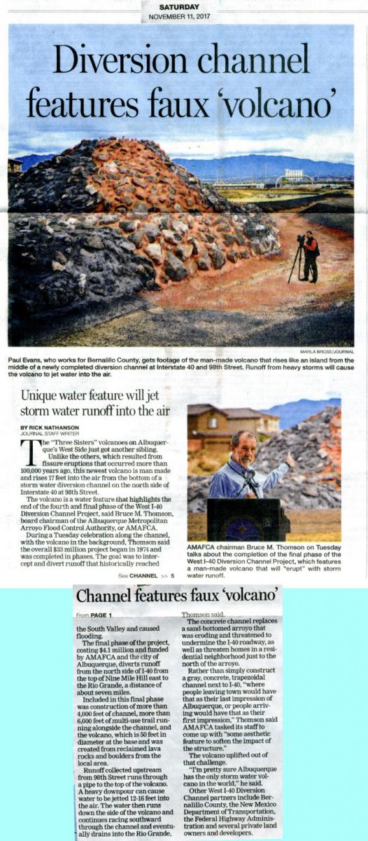
Albuquerque has at least one "volcano" that "erupts" at least once a year. This clever diversion channel is a dynamic art piece that takes advantage of the volcanic setting of Albuquerque's west side. Albuqerque Journal article from November, 2017.
More information about other volcanoes and volcanic fields in the vicinity of Albuquerque:
Cat Hills- Los Lunas- Tomé- Black Butte- Los Piños volcanoes
Some Frequently Asked Questions about the Albuquerque Volcanoes
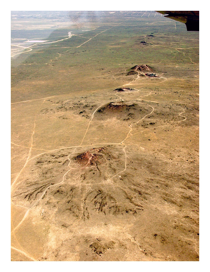
View directed northward along the 10 km-long fissure line of the Albuquerque Volcanoes. JA volcano is the closest volcano. Note the small digitate lava flows radiating from the volcano. Photo L. Crumpler
1. How old are they?
The Albuquerque Volcanoes are as young as 140,000 years. There are several methods of determining ages of basaltic volcanic rocks and each can yield a slightly different result. Some methods yield an age closer to 200,000 years. Ages between 160,000 to 200,000 years old are currently the dates that appear most reasonable based on comparison with geomorphic surfaces around the volcanoes and other factors. Any of these dates are young by the standards of geologic time. Volcanoes younger than 200,000 years in the Southwest are generally well preserved and with the exception of some erosion of their slopes, look close to the morphology they had immediately after eruptions ceased.
Rather than erupting individually like many small fields of volcanoes in the Southwest, the Albuquerque volcanoes all formed simultaneously. This is because they all erupted from the same fissure eruption. The actual eruption probably took place over a period of months to years. To the south and west of Belen and Los Lunas there is another series of cinder cones called the Cat Hills volcanoes. These are slightly younger and consist of more typical cinders and agglomerate.
2. Will they erupt again?
Small volcanoes do not reactivate like big volcanoes, but the area around Albuquerque remains potentially active, mainly because of its location in the Rio Grande rift. A new volcano could erupt, if not along the Albuquerque Volcanoes, at least somewhere within the rift.
One of the larger earthquake swarms in New Mexico occurred in 1972 beneath the volcanoes. There is no particular evidence that this was new magma moving up a crack. Instead, the earthquake swarm may have been re-adjustments of dikes and faults at great depth as the deeper portions of the dike continue to cool and contract.
Many people visiting the volcanoes in the winter months have noticed "warm" air in the caves. This is probably not "volcanic heat", but instead is ambient air trapped in the subsurface that feels warm compared with the cold outside air. If one were to visit the same caves during the summer, one would find them cool compared with the outside air. The caves simply record the temperature of Albuquerque "averaged" over a year, which is around 55 degrees F, a temperature that feels warm in the winter and cool in the summer.
3. How did they form?
If you were to look down on the Albuquerque Volcanoes you would see that they are arranged in a nearly straight line. This also is apparent if you stand on top of one volcano and look across to the next one. This is simply because they erupted along a fracture in the crust. Fractures of this type along which eruptions take place are referred to as "fissure eruptions". Many of the eruptions in Hawaii are fissure eruptions in which the fissures frequently extend outward from summit craters or calderas. The fractures in Hawaii are thought to result from the gradual sliding of parts of the sides of the large volcanoes that make up the Hawaiian islands.
Fissures also occur in Iceland where the crust is being pulled apart along the Mid Atlantic ridge. In New Mexico the fractures have an origin similar to those in Iceland. Here the fractures are part of the faults that formed where the crust has been pulled apart by forces similar to those in Iceland. The eruption that resulted in the Albuquerque Volcanoes probably looked similar to eruptions in Iceland. Although the Albuquerque Volcanoes appear to occur in a straight line, they are actually arranged in slightly offset segments like the fissure in this example from Iceland. This is probably a good analogy of what they looked like when they started erupting and before the eruptions centralized on several spots. Once the eruptions centralized on these spots, the cones that we see today began to build up.
The stretching that helped create the Albuquerque Volcanoes has resulted in the development of the Rio Grande rift. The rift valleys of eastern Africa are another example of similar stretching and pulling apart of Earth's crust. The East African rift and the Rio Grande rift are two of the youngest and largest continental rifts currently active on Earth. (This is probably one reason why East African and New Mexico are among the most geologically, and ecologically, interesting and exotic places on Earth.)
Fissure eruptions occur when conditions are right in the mantle for the existence of partially melted rock (magma) and faults act as conduits for the rise of magma to the surface. When a vertical crack filled with molten magma (known as a "dike") intersects the surface, a line of eruption takes place. If the dike is particularly large and deep, the line of eruption or fissure is long, like the Albuquerque Volcanoes. Other dikes are smaller and the associated fissure eruptions at the surface are relatively short.
4. Why are the Albuquerque Volcanoes important and unusual?
Most of the scoria cones and volcanoes in New Mexico and throughout the Southwestern U.S. are the result of smaller fissure eruptions. This is one reason why the Albuquerque Volcanoes are so unusual and geologically interesting. They are an excellent example of fissure eruption. In addition, few large cities in the United States have such young basaltic volcanoes nearby (within a few minutes drive of downtown) that are also an important part of the metropolitan landscape.
The Albuquerque Volcanoes are also an unusual type of scoria cone. Many scoria cones in the Southwest are piles of cinder. Examples are Capulin volcano, Bandera Crater, and Sunset Crater. Some of the Albuquerque Volcanoes like Vulcan, the largest cone, are cones formed from spatter and thin lava flows coating an interior of cinder.
5. What are they made of?
The Volcanoes are basalt, a type of lava that consists largely of the minerals plagioclase, olivine, pyroxene, and magnetite. There are two principal types of basaltic lava in the Southwest: alkali basalt and tholeiite, defined on the basis of the relative abundances of sodium and potassium. The Albuquerque Volcanoes are made of tholeiite that is low in sodium and especially potassium. These different types of lava reflect the differences in the depth and composition of the mantle rocks that were melted and erupted. By comparison, the youngest lava of El Malpais (McCartys lava flow) is tholeiite. Many of the volcanic fields, like Mount Taylor's collection of small volcanoes, also on the western horizon of Albuquerque, are alkali basalt.
View NM Volcanoes - Albuquerque in a larger map
Explore New Mexico's Volcanoes
New Mexico Volcano Directory
A map of volcanoes and volcanic features around the state, with detailed discussion of each site.
Volcanoes of New Mexico
Return to the introduction
Further Reading
General Geology/Relation to the Rift:
Kelley, V. C., 1982, Albuquerque: Its Mountains, Valley, Water, and Volcanoes. New Mexico Bureau of Mines and Mineral Resources, Scenic Trips to the Geologic Past Series, No. 9, 3rd edition.
Petrology/Lithology:
Baldridge, W. S., 1979, Petrology and petrogenesis of Plio-Pleistocene basaltic rocks from the central Rio Grande rift New Mexico and their relationship to the Rift, in Riecker, R. E., editor, Rio Grande Rift: Tectonism and Magmatism, American Geophysical Union, Washington, D.C., p. 323-353.
Chan, C. F., Thompson, R.A., Zimmer, M.J., Premo, W.R., Shroba, R.R., 2016. Insight into small volume volcanic fields in central Rio Grande rift=Albuquerque Volcanoes, New Mexico. Geological Society of America Abstracts with Programs. Vol. 48, No. 7 doi: 10.1130/abs/2016AM-286572, abstract No. 173-4.
Kelley, V. C., and A. M. Kudo, 1978, Volcanoes and related basalts of Albuquerque basin, New Mexico. New Mexico Bureau of Mines and Mineral Resources, Circular 156, 30p.
Kudo, A.M., 1982, Rift volcanics of the Albuquerque basin: overview with some new data., New Mexico Geological Society Guidebook, 33rd Field Conference, Albuquerque Country II, 285-289.
Perry, F. V., W. S. Baldridge, DePaolo, D.J., 1987, Role of asthenosphere and lithosphere in the genesis of late Cenozoic basaltic rocks from thge Rio Grande Rift and adjacent regions of the southwestern United States. Jour. Geophys. Res., 92, 9193-9213.
Volcanology:
Crumpler, L. S., 1999, Ascent and Eruption at the Albuquerque Volcanoes: A physical volcanology perspective: New Mexico Geological Society Guidebook, 50th Field Conference, Albuquerque Country III, p. 221-233.
Smith, G.A., Florence, P.A., Castrounis, A. D., Luongo, M., Moore, J. D., Throne, J., and Zelley, K., 1999, Basaltic near-vent facies of Vulcan Cone, Albuquerque Volcanoes, New Mexico: New Mexico Geological Society 50th Field Conference Guidebook, Albuquerque Geology, p. 211-219.


