


Geological Overview
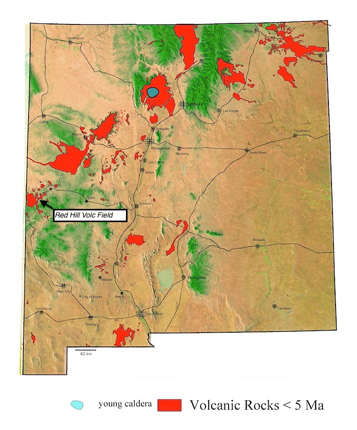
Information about the Red Hill field is sparse, but existing geologic mapping and age determinations show that the area has been active over time significantly enough for inversion of topography to occur; that is, areas of younger volcanism are surrounded by basalt-capped mesas on both sides of Highway 60, about 24 miles east of the border with Arizona and Springerville field.
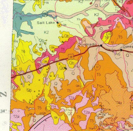
Extract from the state geologic map of the RedHill-Zuni Salt Lake region west of Quemado on Highway 60.
Red Hill cone and flow. Photo L. Crumpler
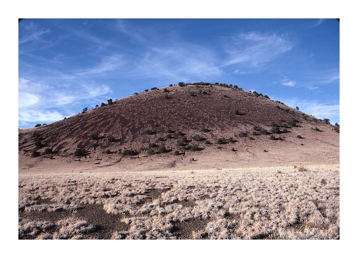
Red Hill cone. Photo L. Crumpler
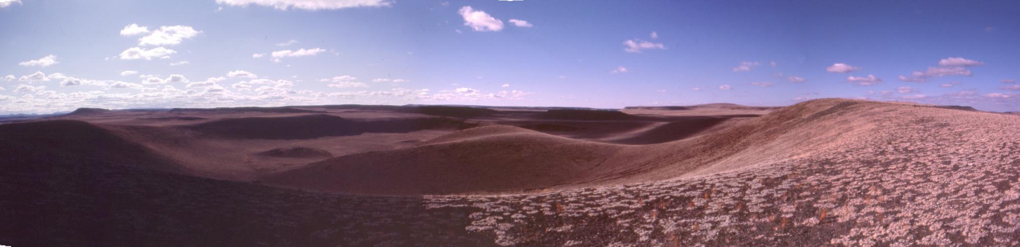
Northward-directed panorama from the rim of Red Hill maar, just south of Highway 60 and Red Hill.
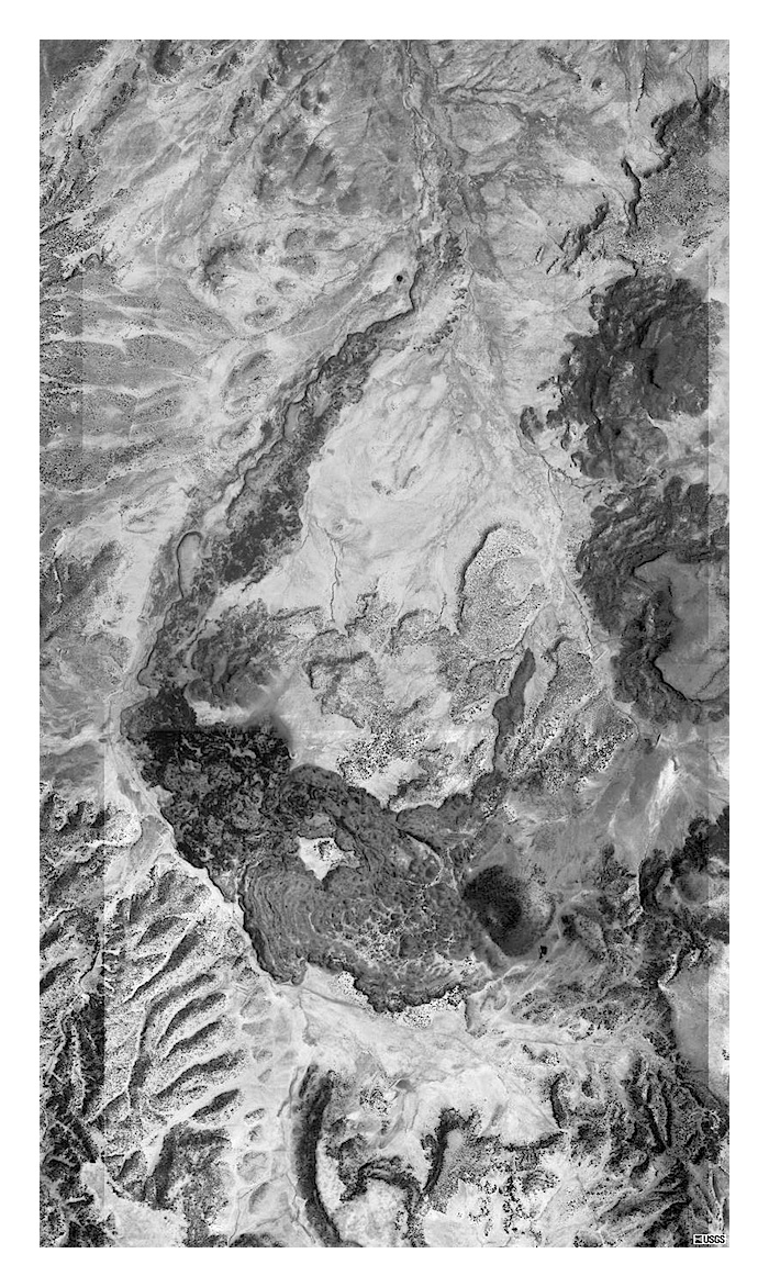
Zuni Salt Lake Maar
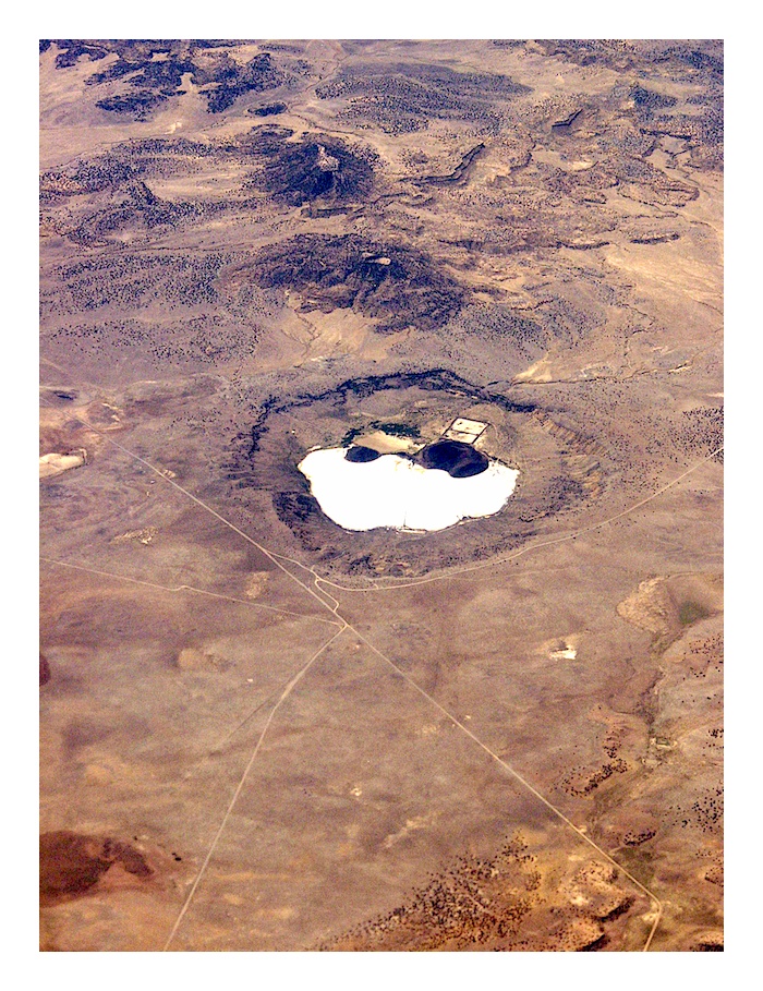
Zuni Salt Lake maar. This photo was acquired from a commercial LA-to-Albuquerque flight. The view is directed south-southeast. The closest town, Quemado, is just out of the top of the image. Photo L. Crumpler
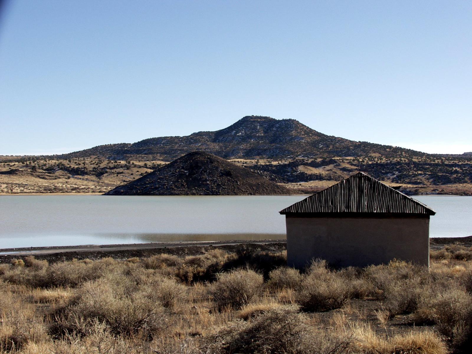
View across the floor of Zuni Salt Lake maar towards the small scoria cone at the base of the south wall. The slopes of the tin roof on a building of the salt-gathering operation appear to be modeled after scoria cone geometry.
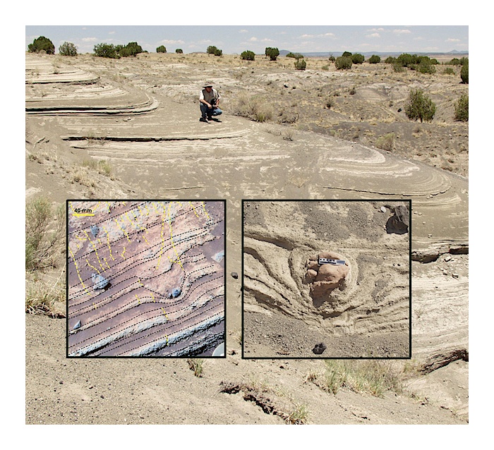
Phreatic tuffs on the western rim of Zuni Salt Lake Maar. Insets, bomb sags. The example on the right is from Zuni Salt Lake maar. The example on the left is from Mars! Photo L. Crumpler
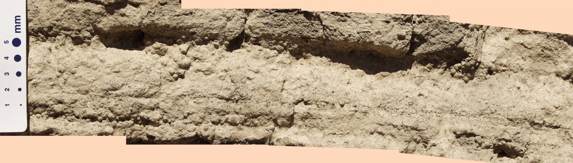
Accretionary lapilli layer in the west wall of Zuni Salt Lake maar.
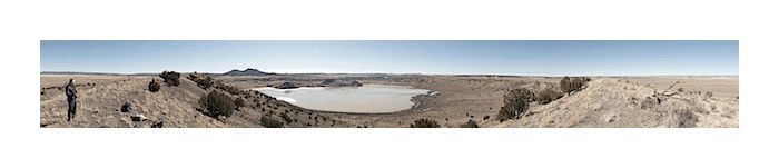 Zuni Salt Lake southward-directed panoramic image. Photo L. Cumpler
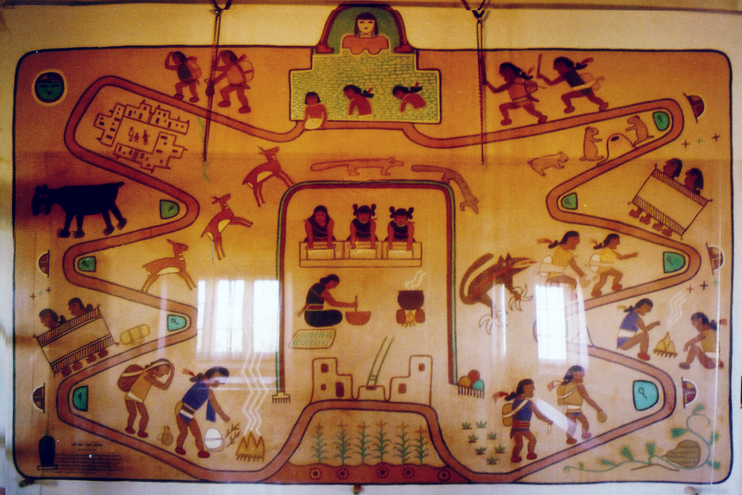
This interesting mural on display at the Petrified Forest depicts the annual trek from Hopi to Zuni Salt Lake to collect salt.
View Red Hill Volcanic in a larger map
References
Chamberlin, R.M., Cather, Steven M., Anderson, Orin J., and Jones, Glen E., 1994. RECONNAISSANCE GEOLOGIC MAP OF THE QUEMADO 30 x 60 MINUTE QUADRANGLE, CATRON COUNTY, NEW MEXICO. New Mexico Bureau of Mines and Mineral Resources Open-file Report 406.
Bradbury, J. P., 1966, Pleistocene-Recent geologic history of Zuni Salt Lake, New Mexico: New Mexico Geological Society 17th Field Conference Guidebook, Taos-Raton-Spanish Peaks Country, New Mexico and Colorado, p. 119.
Crumpler, L. S., and Aubele, J.C., 1990, Red Hill volcanic field, New Mexico; in Wood, C. A., and Kienle, J. (eds), Volcanoes of North America: Cambridge University Press, Cambridge, p. 307-308.
Cummings, D., 1968, Geologic map of the Zuni Salt Lake volcanic crater, Catron County, New Mexico: U. S. Geological Survey, Miscellaneous Geologic Investigations Map I-544, scale 1:6,000.
Darton, N. H., 1906, The Zuni salt lake: Geological Society of America Bulletin, v. 16, p. 564.
Hoffer, J. M., and Corbitt, L. L., 1989, A preliminary note on some unusual explosion-collapse craters, Quemado basalt field, Catron County, New Mexico: New Mexico Geological Society, 40th Field Conference Guidebook, p. 157-158.
Horning, R. R., Dunbar, N.W., Kyle, P. R., and Baldridge, W. S., 1996, Evolution of igneous veins intruding basanite at El Porticito, Quemado, NM: New Mexico Geology, v.18, p. 53.
McIntosh, W. C., 1994, 40Ar/39Ar geochronology of late Miocene to Pleistocene basalts of the Zuni Bandera, Red Hill-Quemado and Potrillo Volcanic Fields: New Mexico Geology, v. 16, p. 6061.
McIntosh, W. C., and Cather, S. M., 1994, 40Ar/39Ar geochronology of basaltic rocks and constraints on Late Cenozoic stratigraphy and landscape development in the Red Hill-Quemado area, New Mexico: New Mexico Geological Society 45th Field Conference Guidebook, p. 209-224.