You are here
Sol 3185
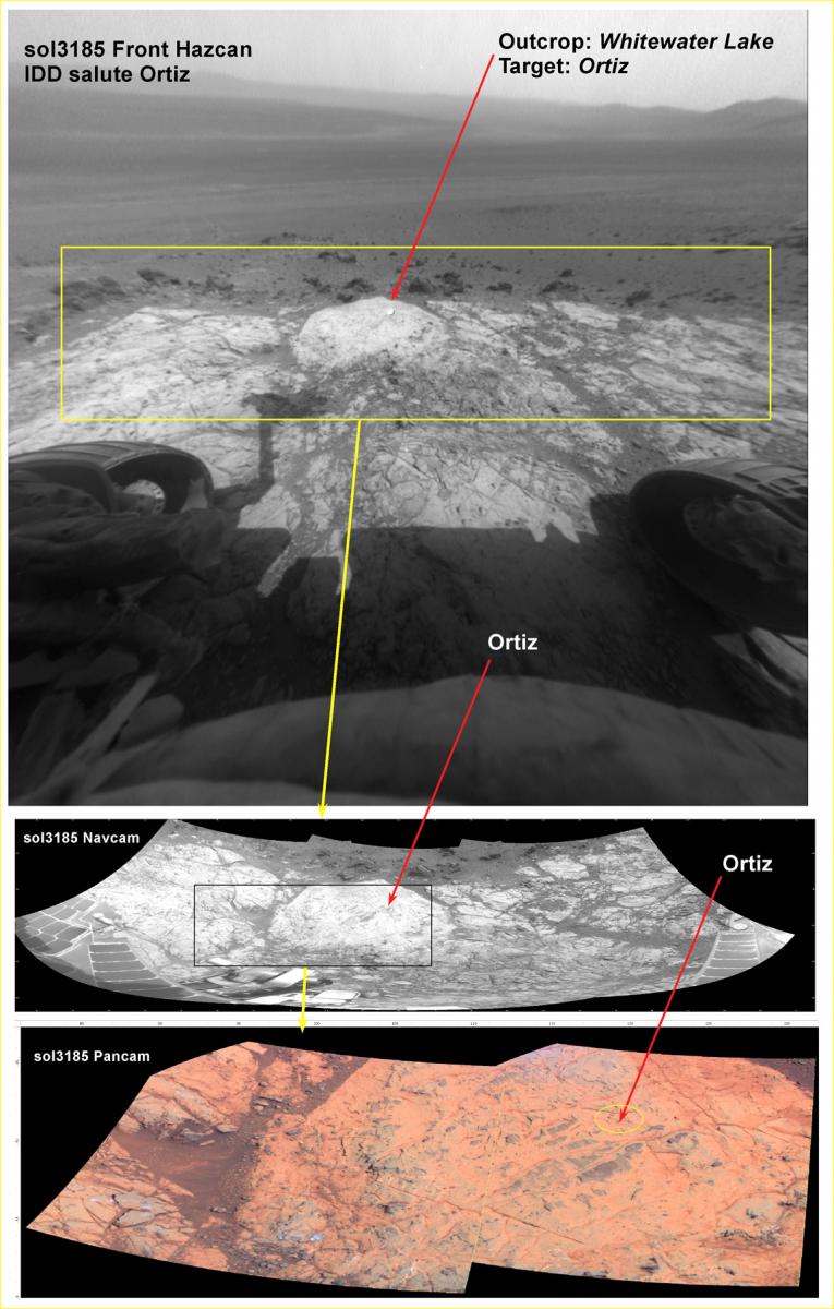
Another New Mexico name gets used for a Mars outcrop target.
The drive to the current target went well. But Opportunity will need to do some “adjustment” bumps in order to put the target in the work volume of the IDD. Because the IDD has a bad shoulder joint, Opportunity can only operate the arm in a single plane, more or less. So the part of any outcrop target that we would like to examine has to be pretty much in that plane and reachable. So careful positioning is necessary with particularly small targets like the one we are attempting to analyze.
This target, which could be an important one here as we search for characteristics in these outcrops that are consistent with clay mineralogy. Since we are trying to examine one of the many small veins that occur within the outcrops here, we will use a name from a gold mine or mining area here on Earth. I suggested that we use the Ortiz gold mining district for naming this target.
The Ortiz Mountains were the site of the first gold rush in the western U.S., pre—dating the CA rush by seven years, at least; the source of most of the gold that was used to pay the traders from the Santa Fe trail; and in many ways more significant to western history than the CA gold rush and other probably more widely known areas of mineral exploration.
Here is the target as seen in stand-off images from this latest drive. We will drive (“bump”) again this sol in order to reach Ortiz. The next downlink on Friday will tell the tale.