


Geological Overview
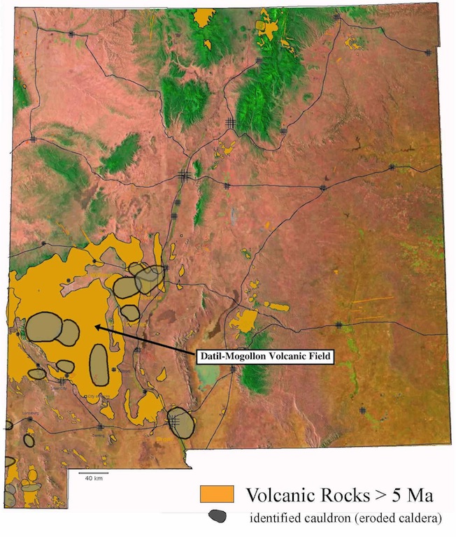
These are older volcanoes and volcanic rocks dating from the Neogene. They represent part of the great ignimbrite flare-up that occurred throughout the Southwest at this time. Many of these eruptions resulted in large calderas similar to the modern Valles Caldera. However, 20 to 35 million years of erosion and faulting have erased most of the morphology of large calderas. Today this area is dominated by massive cliffs of ash flow tuffs and exposures of shallow batholiths consisting of granitic and intermediate volcanic rocks.
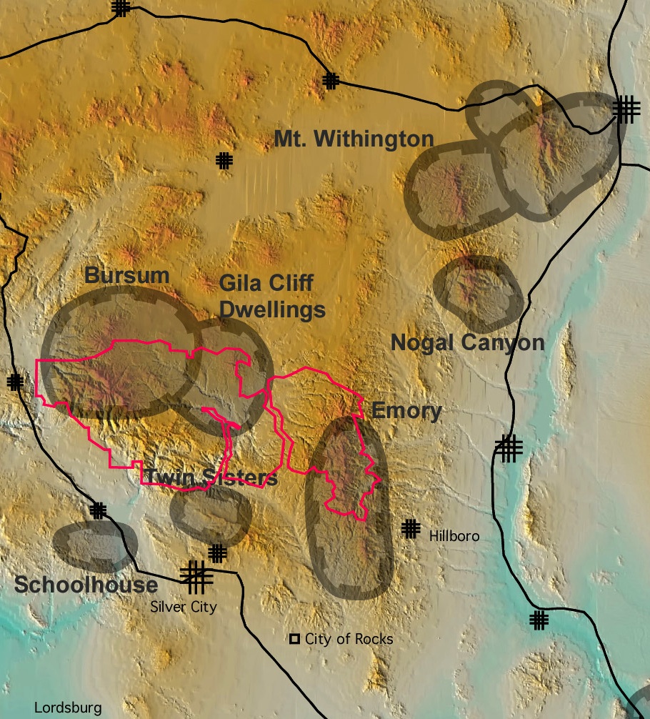
Above is a map showing the principal super eruption sites (large calderas) in relation to modern relief in southwestern New Mexico. Note that the Gila Wilderness is probably a wilderness because the underlying geology is so "wild."
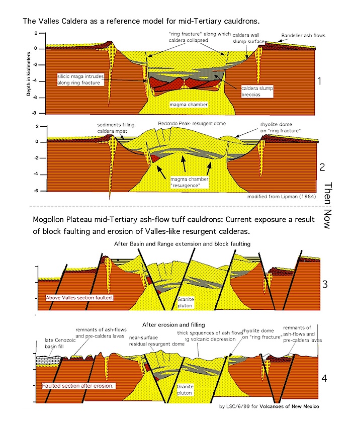
Cross section and state of preservation of an idealized Datil-Mogollon supervolcano. The concept is simple: The current state of preservation is the result of a Valles Caldera type volcano that has been chopped up by Basin and Range faulting and eroded. The result is a chaotic combination of shallow intrusions and surface morphology.
View Datil-Mogollon Volcanic Field in a larger map