You are here
Sol 3262
One last outcrop, then solar conjunction
Opportunity is doing one last "hurrah" here at Cape York on a particularly interesting outcrop with a composition and structure unlike anything encountered before. We were about to start driving southward after the last stop, but the results came down from this strange outcrop. And unlike our tendency to avoid driving back to a previous spot, we decided we had to get more information on this rock unit. Then we have got to start driving south towards the next mountain.
So this will mean staying here through the communication blackout that happens during solar conjunction which is coming up on April 7 and lasts until April 26. This is the period when Mars moves behind the Sun for a few weeks and communication is cut off. Actually communication is only cut off after Mars passes behind the Sun, but the deep space communications people say the communication gets dicey as the edge of the Sun gets close, and we like to avoid commands getting scrambled.
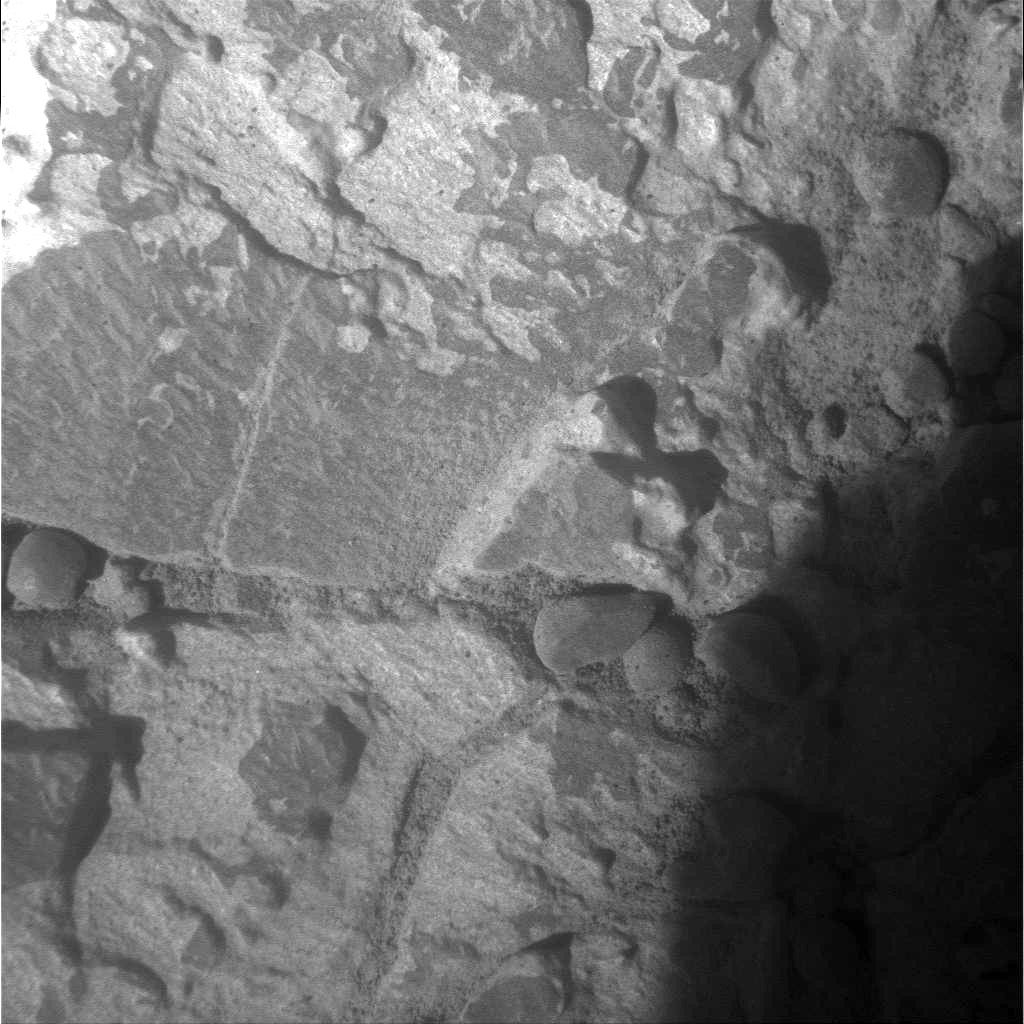
Below are some images from the current location. The outcrop has a "boxwork" structure that on Earth would be the result of deep weathering of bedrock, such as occurs in tropical environments. The boxwork has a composition unlike the host rock. So the stop here is to get some more information about how it formed. Any way you slice it though, it means Mars was really wet when this happened.
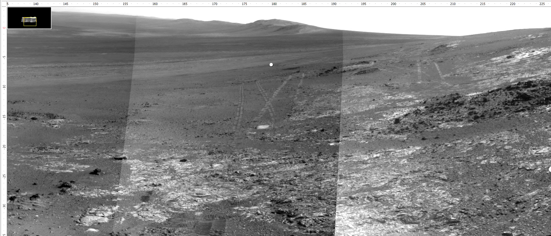
Sol 3262 Navcam mosaic looking in the direction that Opportunity will be driving immediately after solar conjunction. You can see the mountain range to the south where we need to be by August 1. The dot at azimuth of 180 near the image center shows the direction that we will drive. Note all the tracks all over the place. We have been busy on this hill looking at things and trying to do a good job at it while we are doing it.
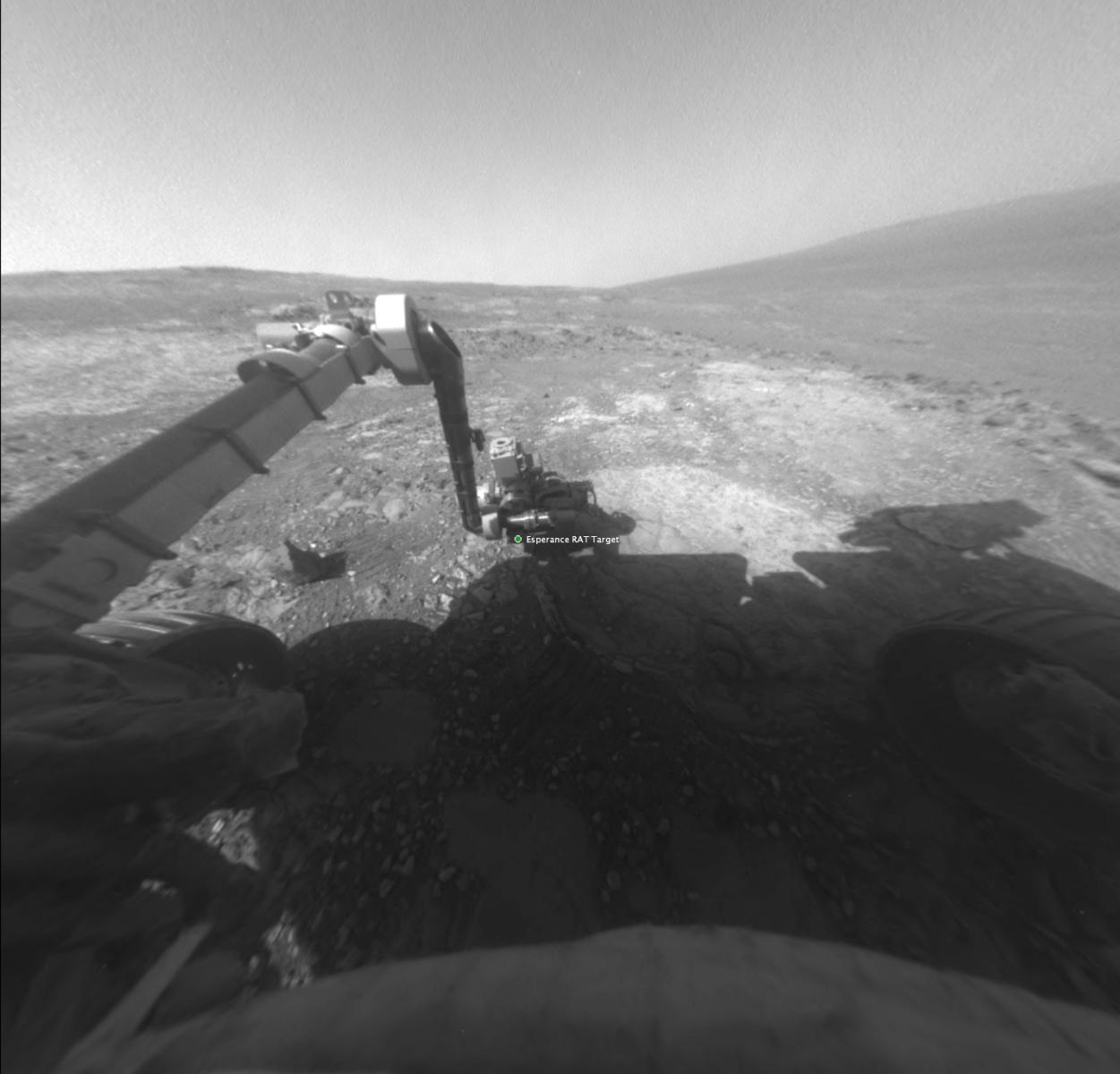
This is a view from the rover's front Hazcam of the outcrop. The view is north across the west flank of Cape York. So the mountains in the distance on the right are the northern rim of the 22 km-diameter Endeavour crater.
This is what the outcrop looks like from the Pancam. You can see the raised rectangular area and how it tends to encircle quasi-orthogonal cores of unaffected rock.
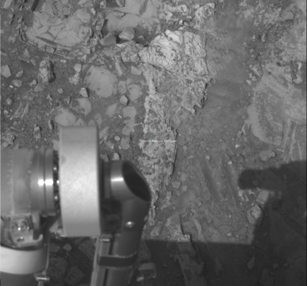
And this is a frame from the Microscopic Imager of the target. The image is about 3 cm across.